Northern Arizona Drought–Part 1
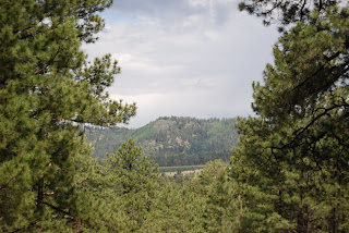
On a sunny afternoon in May I decided to take a drive. I decided to drive down Lake Mary Road, which is on the South side of Flagstaff. The Southwest section of the United States has been experiencing a drought for the past ten years. Many people have seen the evidence of the drought with Lake Meads’ 100 foot level drop evidenced by the bleached rocks of where the water line used to be. On my drive down Lake Mary Road, I past Lake Marry, which is divided into Upper and Lower Lake Mary. Lower Lake Mary is nearly dried up at this time. Upper Lake Mary the larger of the two still has water, but it low. I continued past and on towards Mormon Lake which is about 25 miles south of Flagstaff. It is the largest natural lake in Arizona, and at the moment is nearly dried up. What follows are some pictures that I took with my phone’s camera, so please excuse the lack of quality.
The following series will constitute Part 1 of my series. Since taking these photos the monsoon season has kicked into to full gear. It has not been an exceptionally wet monsoon season. I will be going out to Mormon Lake and taking more photos to see if there has been any change.


Comments